
Select NOAA-NWS Forecast Office Text Products
(Product availability varies with seasons, forecast office, and weather.)
Hazardous Weather Outlook for Duluth, MN
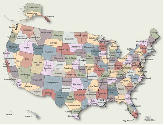
To Select Another NWS Office Click on Map or Choose from List
|
| Select Forecast Office: | Select Product: |
846 FLUS43 KDLH 142010 HWODLH Hazardous Weather Outlook National Weather Service Duluth MN 310 PM CDT Tue May 14 2024 MNZ010>012-018>021-025-026-033>038-WIZ001>004-006>009-152015- Koochiching-North St. Louis-Northern Cook/Northern Lake- North Itasca-Central St. Louis-Southern Lake/North Shore- Southern Cook/North Shore-North Cass-South Itasca-South Cass- Crow Wing-Northern Aitkin-South Aitkin-Carlton/South St. Louis- Pine-Douglas-Bayfield-Ashland-Iron-Burnett-Washburn-Sawyer-Price- 310 PM CDT Tue May 14 2024 This Hazardous Weather Outlook is for portions of northeast Minnesota and northwest Wisconsin. .DAY ONE...This afternoon and Tonight Areas of frost are likely again tonight, and a Frost Advisory is in effect for portions of northwest Wisconsin and the Minnesota Arrowhead. .DAYS TWO THROUGH SEVEN...Wednesday through Monday The probability of widespread hazardous weather is low. .SPOTTER INFORMATION STATEMENT... Skywarn spotter activation will not be needed this afternoon or tonight. $$ LSZ121-140>148-150-152015- Bayfield to Oak Point WI-Grand Portage to Grand Marais MN- Grand Marais to Taconite Harbor MN- Taconite Harbor to Silver Bay Harbor MN- Silver Bay Harbor to Two Harbors MN-Two Harbors to Duluth MN- Duluth MN to Port Wing WI-Port Wing to Sand Island WI- Sand Island to Bayfield WI-Oak Point to Saxon Harbor WI- Outer Apostle Islands Beyond 5 NM from Mainland- 310 PM CDT Tue May 14 2024 This Hazardous Weather Outlook is for portions of Lake Superior and the Nearshore waters of western Lake Superior. .DAY ONE...This afternoon and Tonight Northeast winds gusting 20 to 25 knots and waves of 3 to 4 feet expected through afternoon around the Twin Ports and from the eastern portion of the Bayfield Peninsula to Saxon Harbor. .DAYS TWO THROUGH SEVEN...Wednesday through Monday Breezy northeast winds 20 to 30 knots with waves 3 to 5 feet expected Wednesday, especially around the Twin Ports. $$ Levens More information may be obtained at the following web address: http://www.weather.gov/duluth |
Previous Hazardous Weather Outlooks may be found at
NWS Duluth, MN (DLH) Office Hazardous Weather Outlooks.
(Click 'Previous Version' there to view past versions successively.
Some may differ only in time posted.)
Products Courtesy of NOAA-NWS
NWS Information Parsing Script by Ken True at Saratoga Weather - WFO and Products Scripts by SE Lincoln Weather.
Mapping by Curly at Michiana Weather and by Tom at My Mishawaka Weather.